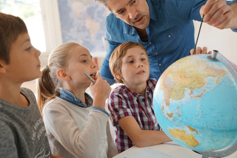
The Importance of Teaching Map Skills
In this day and age of smartphones and tablets, many are left to wonder: why even teach map skills to students? If someone is trying to go somewhere, is it not just easier to type in the destination and let technology take care of the rest? Perhaps for a trip across town to a store you have never visited before, but maps can do so much more for kids.
Maps provide so much more than a GPS system. As a teacher I found that my students had no concept of size when it came to comparing one geographic feature to another. Many thought that Texas and Alaska were about the same size as many of the other states in the U.S.
Maps are not only important when teaching about spatial recognition but also global issues like climate change. Students can actually use an average temperature map to see temperature trends in a part of the world such as the polar ice caps. Students can then use this information when studying animal migration or extinction patterns. Kids can actually see the world change in terms of political power as groups such as the Romans and British expanded their influence and colonized different regions of the world.
Activities for Teaching Map Skills
Where in the World?
One of my “go to” map activities I used as a geography teacher is what I called “Where in the World?” This activity entails giving students some basic demographic information about a group of people living sometime in history. Were the people nomads or hunter/gatherers, agricultural or industrial?
Given the specific demographics and a time period, students are asked to study a physical geographic map and decide where in the world would be the best region in which to live. Student groups would then present their findings and decisions to the class. The class could ask questions and then vote on the group’s proposal. This not only gets students interested in maps but also gives them public speaking/presenting skills.
Cartographer Activity
Another activity that my students really enjoyed was a cartographer activity. In this activity I supplied the students with an early historical map for a region such as the Americas. Students would take that map and a current map and compare/contrast the two maps and discuss what the cartographers got correct (most traveling by boat and land) compared to a current map of the same area.
This activity is a great jumping off point for discussions around the time it took early cartographers to draw these maps as well as the limited resources the cartographers had compared to tools we use today such as satellite images.
Military Leaders and Their Quests
A third great activity combines historically aggressive military leaders/nations and their quests to colonize/take over large areas of the world. We would study maps that showed the expansions of societies under leaders like Gengis Khan, Emperor Trajan, Napoleon Bonaparte, Benjamin Disraeli, Adolph Hitler, etc. What led to such expansions? What led to the downfall of such expansions? Were local people responsible for the downfall of the empires or were physical features responsible (think of the Russian winter during World War II that stalled the Nazi march in Russia)?
Not only does this exercise help develop map reading skills, it also brings discussions regarding humanity into play. This is a powerful tool to use in a social studies class that can combine map skills with political science discussions.
How the United States has Changed
Maps are a great resource for studying U.S. history. Think about a map of the United States and how it would have changed between 1776 and 1860. Students could see how the European Americans expanded westward during this time. Students could analyze purchases the new U.S. government made with other countries to obtain larger parts of the United States and how those purchases affected groups like the Native Americans and Hispanic residents. How were presidents like Thomas Jefferson and James Monroe involved in the expansion? How were native populations treated during each major land purchase or conquest?
U.S. Resources
If you have a class of younger students, you could use a resource map of the United States around the turn of the 20th century. You could divide students into groups giving each group a region of the United States. That group would explore the different resources of the region and how that region contributed to the resource supply for the rest of the country. Think about how regions were named: The Corn Belt, The Cotton Belt, The Fruit Belt, and The Wheat Belt are just a few examples. What made these regions ideal for growing these crops? How were the crops harvested and transported to other parts of the United States?
These are just a few examples of activities that you can use in class to get your students to interact with maps. Maps are powerful documents that teach our classes about the history of the world and how much the earth has changed in a relatively short period of time.